Historické mapy
Home (Úvod)
Application Enter
Authors gallery
Project information
Application help
Search
Map sets
Year of publication
Region
Author
Scale
Type
Theme of the map
Local maps
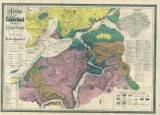
Geological map of the Cheb district (1852)
City map of Karlovy vary and its environs (1855)
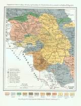
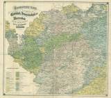
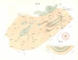
Geognostic map of northern Carpathians in Silesia and border areas of Moravia and Galicia (1861)
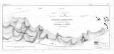
Layout plan and geological map of the Barrande colonies „Haidinger“ and „Krejčí“ in Silurian System of Bohemia (1860)
Geological map of the environs of Česká Lípa (1862)
Geognostic map of the environs of Karlovy Vary, Františkovy Lázně and Mariánské Lázně (1863)
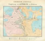
Geognostic conditions in the environs of Letovice in Moravia (1863)
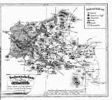
Synoptic geological-mining map of the area of the Cheb Chamber of Commerce (1863)
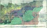
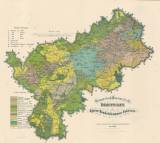
Earth scientific/geographic map of the Prague environs, (1863)
(C) Czech Geological Survey 2004
www.geology.cz