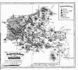
 Geognostische Karte der Umgebung von Böhmisch-Leipa Geognostische Karte der Umgebung von Böhmisch-Leipa(Geological map of the environs of Česká Lípa) Author: Watzel, Kajetan Author's comment: Drawn by Ern. Preisler. Lithography by J. Müller. Typography by Phil.Geržabek, Česká Lípa Country: Czech Republic; Czech Crownlands Document language: German Publisher: k.k. Ober-Gymnasium zu Böhmisch-Leipa, Česká Lípa, first edition Supplement to a paper by K. Watzel: Beschreibung der im Horizonte von Böhmisch-Leipa vorkommen. Gesteine und Mineralien, published in "Programm des k.k. Ober-Gymnasiums zu Böhmisch-Leipa am Schlusse des Schuljahres 1862". Česká Lípa Year: 1862 Scale: 1 : 288 000 Theme of the map: petrographical map, map of mineral deposits Type: Map supplement Color: Black and white Form: Bound appendix Kind: Printed Original source for this digital copy : Czech Geological Survey, Prague Original dimensions: 189 x 222 mm (height x width) |


