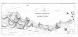
 Situationsplan und geologische Karte über die Barrande'schen Colonien "Haidinger "und "Krejčí" in der Silurformation Böhmens Situationsplan und geologische Karte über die Barrande'schen Colonien "Haidinger "und "Krejčí" in der Silurformation Böhmens(Layout plan and geological map of the Barrande colonies „Haidinger“ and „Krejčí“ in Silurian System of Bohemia ) Author: Lipold, Marcus Vincenz Author's comment: Country: Czech Republic Document language: German Publisher: Kaiserlich-königliche Geologische Reichsanstalt, Wien, first edition Supplement (Table II) to a paper by M.V.Lipold: Über Herrn J. Barrande's, Colonien' in der Silur-Formation Böhmens, published in v "Jahrbuch der k.k. geologischen Reichsanstalt", vol. 12, No. 1. Wien 1861 Year: 1860 Scale: 1 : 28 800 Theme of the map: geological map with Quaternary deposits Type: Map supplement Color: Black and white Form: Bound appendix Kind: Printed Original source for this digital copy : Czech Geological Survey, Prague Original dimensions: 218 x 496 mm (height x width) |


