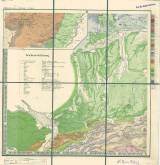
 Geognostische Karte des Königreichs Bayern und der angrenzenden Länder Geognostische Karte des Königreichs Bayern und der angrenzenden Länder[Neuburg-Ulm-Murnau III. SW] (Geological map of the Kindom of Bavaria and adjacent countries) ([Neuburg-Ulm-Murnau III.SW]) Author: Gümbel, Carl Wilhelm Author's comment: With use of studies of numerous geologists and according to their own investigations; J.G.Cotta, litographer and printer, München Country: Bavaria; Germany Document language: German Publisher: publisher not specified, first edition Year: 1858 Scale: 1 : 500 000 Theme of the map: geological map with Quaternary deposits Type: Map Color: Coloured Form: Set of sequential folded sheets Kind: Printed Original source for this digital copy : Map collection of the estate of Professor Kettner, Charles University, Prague Original dimensions: 402 x 401 mm (height x width) |


