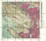
 [Geognostische Karte des Koenigreiches Bayern. Zweite Abtheilung] [Geognostische Karte des Koenigreiches Bayern. Zweite Abtheilung][Das Ostbayerische Grenzgebirge oder das Bayerische und Oberpfälzer Waldgebirge in 5 Blättern] Blatt Erbendorf, No VIII ([Geological map of the Kindom of Bavaria. Second part]) ([East Bavarian border mountain range, i.e., Bayerischer Wald (Bavorský les) and Oberpfalzer Wald (Hornofalcké pohoøí) on 5 map sheets] Sheet Erbendorf, No.VIII) Author: Gümbel, Carl Wilhelm Author's comment: Printer C.Hellfarth, Gotha Country: Bavaria; Germany Document language: German Publisher: Justus Perthes, Gotha Year: 1866 Scale: 1 : 100 000 Theme of the map: geological map with Quaternary deposits Type: Map Color: Coloured Form: Folded map Kind: Printed Original source for this digital copy : collection of Professor Kettner Original dimensions: 610 x 612 mm (height x width) |