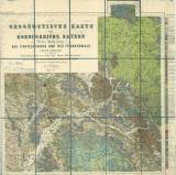
 Geognostische Karte des Koenigreichs Bayern, Dritte Abtheilung Geognostische Karte des Koenigreichs Bayern, Dritte Abtheilungdas Fichtelgebirge und der Frankenwalde nebst Vorland, Blatt Kronach (No XII) (Geological map of the Kingdom of Bavaria, Third part ) (Smrčiny (Fichtelgebirge) and Franský les (Frankenwald) Mountains with foothills,Map sheet Kronach (No.XII)) Author: Gümbel, Carl Wilhelm Author's comment: Draftsman Ed.Gronen, engraver V.Geyer, printer C.Hellfarth Country: Bavaria; Germany Document language: German Publisher: Kgl. bayerische Oberbergamt, München, first edition Year: 1877 Scale: 1 : 100 000 Theme of the map: geological map with Quaternary deposits Type: Map Color: Coloured Form: Loose map Kind: Printed Original source for this digital copy : Map collection of the estate of Professor Kettner, Charles University, Prague |


