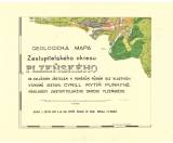
 Geologická mapa zastupitelského okresu plzeňského Geologická mapa zastupitelského okresu plzeňskéhose zvláštním zřetelem k poměrům půdním [List 5] (Geological map of representative district of Plzeň) (with special emphasis on soil conditions [Map sheet 5]) Author: Purkyně, Cyril Author's comment: Compiled by Cyril count Purkyně according to his own studies. Situation drawn by E.F.Beneš with the use of C.and K. Military Geographic Institute in Vienna Country: Czech Republic; Czech Crownlands Document language: Czech Publisher: Zastupitelský okres plzeňský, Plzeň, first edition Year: 1910 Scale: 1 : 30 000 Theme of the map: soil map, geological map with Quaternary deposits Type: Map Color: Coloured Form: Set of sequential loose sheets Kind: Printed Original source for this digital copy : Czech Geological Survey, Prague Original dimensions: 321 x 425 mm (height x width) |