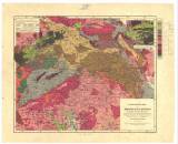
 Franz Foetterle's Geologischer Atlas des Österreichischen Kaiserstaats… Erste Lieferung Franz Foetterle's Geologischer Atlas des Österreichischen Kaiserstaats… Erste LieferungGeologische Karte des Königreiches Böhmen - Mittlerer und östlicher Theil (F.Foetterle’s Geological atlas of Austrian Monarchy) (Geological map of the Kingdom of Bohemia – central and eastern part ) Author: Foetterle, Franz Author's comment: based on data of the Imparial Geological Survey and studies of J. Barrande, B. Cotta, W. Haidinger, K. Naumann, A.E. Reuss, F. Zippe and others. Typ. C. Hellfarth, Goth Country: Czech Republic; Poland; Czech Crownlands; Germany Document language: German Publisher: Justus Perthes, Gotha Year: 1858 Scale: 1 : 750 000 Theme of the map: geological map with Quaternary deposits Type: Map Color: Coloured Form: Loose map Kind: Printed Original source for this digital copy : Czech Geological Survey, Prague Original dimensions: 325 x 393 mm (height x width) |


