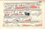
 [Geognostische Karte der Gegend bei Vranov, Přestavlk und Soběhrad nördlich von Benešov] [Geognostische Karte der Gegend bei Vranov, Přestavlk und Soběhrad nördlich von Benešov][Längsdurchschnitte, Durchschnitte] -Taf.II ([Geognostic map of the landscape in the region of Vranov, Přestavlk and Soběhrad to the north of Benešov]) (Sections – Tab. II) Author: Helmhacker, Rudolf Author's comment: Lithographher Bohemia, Praha Country: Czech Republic; Czech Crownlands Document language: German Publisher: Fr. Řivnáč (commission publisher), Prague, first edition Supplement to the article Geognost. Beschreibung eines Theiles d.Gegend zwischen Benešov u. Sázava, published parallel in the czech and german version in the series "Archiv pro přírodovědecký výzkum Čech / Archiv für die naturwissenschaftliche Durchforschung von Böhmen", vol. 2/1 Year: 1871 Scale: 1 : 28 800 Theme of the map: geological map with Quaternary deposits Type: Graphic insert Color: Coloured Form: Bound supplement Kind: Printed Original source for this digital copy : Czech Geological Survey, Prague |
| Other variety of this document |