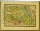
 Prozkoumání Čech. Sekce VI. Prozkoumání Čech. Sekce VI.Geologická mapa. [Okolí Kutné Hory až České Třebové] (Exploration of Bohemia. Section VI.) (Geological map. [The environs of Kutná Hora as far as Česká Třebová]) Author: Krejčí, Jan Country: Czech Republic; Czech Crownlands Document language: Czech, German Publisher: Fr. Řivnáč (commission publisher), Prague, first edition Published concurrently in Czech and German versions in collection " Archiv pro přírodovědecký výzkum Čech" (Archiv für die naturwissenschaftliche Landesdurchforschung von Böhmen), vol.VII/6 Year: 1891 Scale: 1 : 200 000 Theme of the map: geological map with Quaternary deposits Type: Map Color: Coloured Form: Loose map Kind: Printed Original source for this digital copy : Czech Geological Survey, Prague Original dimensions: 397 x 585 mm (height x width) |
| Other variety of this document |


