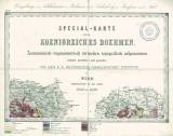
 Nr. Ib. Umgebungen von Schlukenau in Böhmen und Seidenberg in Preussen nebst Titel Nr. Ib. Umgebungen von Schlukenau in Böhmen und Seidenberg in Preussen nebst Titel[Special-Karte des Koenigreiches Boehmen] (Environs of Šluknov in Bohemia and Seidenberg in Prussia) Author: Jokély, Johann Country: Czech Republic; Czech Crownlands; Prussia Document language: German Publisher: K.k. Geologische Reichsanstalt, Wien, first edition Geological situation is delineated into the printed topographic groundwork of a special map derived from the II. military mapping (Francis´s) 1847-1860. Year: 1863 Scale: 1 : 144 000 Theme of the map: geological map with Quaternary deposits Type: Map Color: Coloured Form: Loose map Kind: manuscript Original source for this digital copy : Map collection of the estate of Professor Kettner, Charles University, Prague , Czech Geological Survey – Geofond, Prague Original dimensions: 265 x 397 mm (height x width) |
| Other variety of this document |


