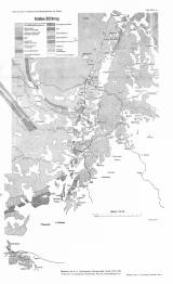
 [Geologická mapa okolí Ivančic, Rosic a Moravského Krumlova] [Geologická mapa okolí Ivančic, Rosic a Moravského Krumlova](Geological map of the environs of Ivančice, Rosice and Moravský Krumlov) Author: Suess, Franz Eduard Author's comment: Drawn by G. Skala. typ. Freytag und Berndt, Wien Country: Czech Republic; Czech Crownlands Document language: German Publisher: Kaiserlich-königliche Geologische Reichsanstalt, Wien, first edition Supplement (Table 18) to a paper by F.E. Suess: Die Tektonik des Steinkohlengebietes von Rossitz und der Ostrand des böhmischen Grundgebirges, published in "Jahrbuch der k.k. geologischen Reichsanstalt", sv. 57. Wien 1907 Year: 1907 Scale: 1 : 125 000 Theme of the map: geological map with Quaternary deposits Type: Map supplement Color: Black and white Form: Bound appendix Kind: Printed Original source for this digital copy : Czech Geological Survey, Prague Original dimensions: 488 x 286 mm (height x width) |


