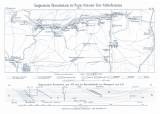
 Geognostische Übersichtskarte der Rossitz-Oslavaner Steinkohlenformation Geognostische Übersichtskarte der Rossitz-Oslavaner Steinkohlenformation(Synoptic geognostic map of the Rosice-Oslavany bituminous coal unit) Author: Helmhacker, Rudolf Author's comment: Lithography and typography by F. Köke, Wien Country: Czech Republic; Czech Crownlands Document language: German Publisher: Kaiserlich-königliche Geologische Reichsanstalt, Wien, first edition Supplement (Table 3) to a paper by W. Helmhacker: Übersicht der geognostichen Verhältnisse der Rossitz-Oslavaner Steinkohlenformation, published in "Jahrbuch der k.k. geologischen Reichsanstalt", vol. 16. Wien 1866 Year: 1866 Scale: 1 : 48 000 Theme of the map: map of mineral deposits Type: Map supplement Color: Black and white Form: Bound appendix Kind: Printed Original source for this digital copy : Czech Geological Survey, Prague Original dimensions: 120 x 283 mm (height x width) |


