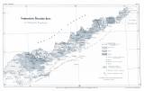
 Geognostische Übersichts-Karte des böhmischen Erzgebirges Geognostische Übersichts-Karte des böhmischen Erzgebirges(Synoptic geognostic map of the Czech part of the Krušné hory Mountains ) Author: Jokély, Johann Country: Czech Republic Document language: German Publisher: Kaiserlich-königliche Geologische Reichsanstalt, Wien, first edition Supplement (Table 6) to a paper by J.Jokély: Das Erzgebirge im Leitmeritzer Kreise in Böhmen, published in "Jahrbuch der k.k. geologischen Reichsanstalt", vol. 9 Wien 1858 Year: 1858 Scale: 1 : 360 000 Theme of the map: petrographical map Type: Map supplement Color: Black and white Form: Bound supplement Kind: Printed Original source for this digital copy : Czech Geological Survey, Prague Original dimensions: 216 x 359 mm (height x width) |


