Home
|
Project information
|
Contents CD
|
User Manual
|
Map grid ZM
|
Map grid G-K
|
Sheets of administrative units
|
Map coverage
|
Authors CD
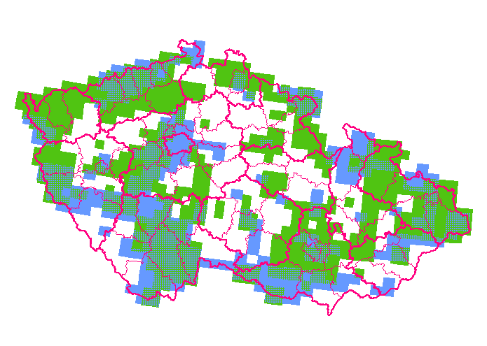
The area of the Czech Republic covered by geological maps at the scale of 1:25 000
Display:
map grid G-K
map grid ZM
maps in the S-42 coordinate system
with the Gauss-Krüger's projection
maps in the S-JTSK coordinate system
with the Krovak's projection
both map types