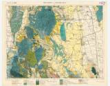
 Z 11 Kol XXV Tóketerebes und Nagyszaláncz [4567] Z 11 Kol XXV Tóketerebes und Nagyszaláncz [4567](Trebišov and Slanec) Country: Slovakia; Austria-Hungary Document language: German Publisher: publisher not specified, first edition Geological special map of the kindom and countries constituting the Austro-Hungarian Empire with geological setting, possible period of origin: the beginning of 20th century Year: Scale: 1 : 75 000 Theme of the map: geological map with Quaternary deposits Type: Map Color: Coloured Form: Loose map Kind: manuscript Original source for this digital copy : HKG – Central Provincial Bureau at Banská Štiavnica HKG 10003 |


