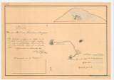
 Karte über den Balazsover Eisenstein Bergbau Karte über den Balazsover Eisenstein Bergbau(Map of iron mine at Bláže) Author: Huszár, Anton Country: Slovakia; Czech Crownlands Document language: German, Slovak Publisher: publisher not specified Year: 1839 Scale: 1 : 675 Theme of the map: mining map Type: Graphic insert Color: Coloured Form: Loose sheet Kind: manuscript Original source for this digital copy : HKG – Central Provincial Bureau at Banská Štiavnica HKG 9216 Original dimensions: 250 x 360 mm (height x width) |


