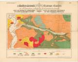
 A körmöczi bányavidék földtani térképe a Nándor altáró kitüntetésével A körmöczi bányavidék földtani térképe a Nándor altáró kitüntetésével(Geological map of the environs of Kremnice showing section of the Ferdinand drainage adit from Dolná Ves as far as its mounth in the River Hron) Authors: Tirscher, Jószef; Duschek, Ján Country: Slovakia; Austria-Hungary Document language: French, Hungarian, German Publisher: publisher not specified, first edition Year: 1895 Scale: 1 : 14 400 Theme of the map: geological map with Quaternary deposits, mining map Type: Map Color: Coloured Form: Loose map Kind: Printed Original source for this digital copy : BRK – State Directorate of Mines in Kremnica BRK 67 Original dimensions: 720 x 920 mm (height x width) |


