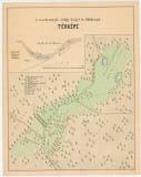
 A zseleznyói völgy helyi és földtani térképe A zseleznyói völgy helyi és földtani térképe(Topographic and geological map of Železna dolina Valley ) Author's comment: Indecipherable signature of the author Country: Slovakia; Austria-Hungary Document language: Hungarian, Slovak Publisher: publisher not specified, first edition Year: 1881 Scale: 1 : 100 Theme of the map: geological map with Quaternary deposits, mining map Type: Map Color: Coloured Form: Loose map Kind: manuscript Original source for this digital copy : HKG – Central Provincial Bureau at Banská Štiavnica HKG 10002 Original dimensions: 340 x 440 mm (height x width) |


