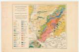
 A Kis Kárpátoknak földtani térképe A Kis Kárpátoknak földtani térképe(General geological map of the Malé Karpaty Mountains ) Country: Slovakia; Austria-Hungary Document language: Hungarian, German Publisher: K.k. Geologische Reichsanstalt, Wien, first edition Possible period of origin: the end of 19 century Year: Theme of the map: geological map with Quaternary deposits Type: Map Color: Coloured Form: Loose map Kind: Printed Original source for this digital copy : HKG – Central Provincial Bureau at Banská Štiavnica HKG 9993 Original dimensions: 200 x 250 mm (height x width) |


