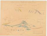
 A vihnyei Ó – Antaltáró által föltárt telerek települési viszonyai A vihnyei Ó – Antaltáró által föltárt telerek települési viszonyai(Interpretation of the origin of ores in the open Stará štola Anton (Old Anton adit at Vihne)) Country: Slovakia; Austria-Hungary Document language: Hungarian, Slovak Publisher: publisher not specified, first edition Possible period of origin: the end of 19 century Year: Theme of the map: geological map with Quaternary deposits, mining map Type: Graphic insert Color: Coloured Form: Loose map Kind: manuscript Original source for this digital copy : HKG – Central Provincial Bureau at Banská Štiavnica HKG 8747 Original dimensions: 530 x 700 mm (height x width) |


