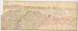
 Geognostische Karte über das Schemnitzer Erzgebirge mit einem sich von West nach Ost erstreckenden Gebirgs Durchschnitte Geognostische Karte über das Schemnitzer Erzgebirge mit einem sich von West nach Ost erstreckenden Gebirgs Durchschnitte(Geological map of Bánská Štiavnica ore district with longitudinal section from the east to the west ) Author: Lenger, Jozef Ernest Country: Slovakia; Austria-Hungary Document language: German Publisher: publisher not specified, first edition scale in Štiavnice fathoms Year: 1835 Theme of the map: geological map with Quaternary deposits, mining map Type: Graphic insert Color: Coloured Form: Loose map Kind: manuscript Original source for this digital copy : HKG – Central Provincial Bureau at Banská Štiavnica HKG 6448 Original dimensions: 340 x 910 mm (height x width) |


