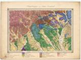
 Umgebungen von Rima Szombath Umgebungen von Rima Szombath(The environs of Rimavská Sobota) Country: Slovakia; Austria-Hungary Document language: German Publisher: K.k. Geologische Reichsanstalt, Wien Geological situation is delineated into the printed topographic groundwork of a special map derived from the II. military mapping (Francis´s) 1847-1860. Year: 1870 Scale: 1 : 144 000 Theme of the map: geological map with Quaternary deposits Type: Map Color: Coloured Form: Loose map Kind: manuscript Original source for this digital copy : BKNV – Mining Captaincy in Spišská Nová Ves BKNV 3863 Original dimensions: 350 x 480 mm (height x width) |


