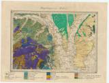
 Umgebungen vin Miskólcz Umgebungen vin Miskólcz(The environs of Miškovec) Author: Stitz, F. Country: Slovakia; Austria-Hungary Document language: German Publisher: K.k. Geologische Reichsanstalt, Wien Geological setting plotted on the first printed topographic specialized military map of the Austrian general staff (Special-Karte des Koenigreiches Boehmen, K.k. militärisch-geographische Institut, Wien) Year: 1871 Scale: 1 : 144 000 Theme of the map: geological map with Quaternary deposits Type: Map Color: Coloured Form: Loose map Kind: manuscript Original source for this digital copy : HKG – Central Provincial Bureau at Banská Štiavnica HKG 10007 Original dimensions: 280 x 390 mm (height x width) |


