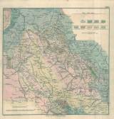
 [Geognostická mapa části dolnoslezsko-českého pomezí] [Geognostická mapa části dolnoslezsko-českého pomezí]([Geological map of a part of Lower Silesian-Bohemian border area] ) Authors: Carnall, Rudolf von; Zobel, O. Author's comment: Drawn by Becksch Country: Czech Republic; Czech Crownlands Document language: German Publisher: publisher not specified, first edition Supplement (Fig. I) to a paper by O. Zobel and R. von Carnall:Geognostische Beschreibung von einem Theile des Nieder-Schlesischen, Glätzischen und Böhmischen Gebirges, published in "Archiv für Mineralogie, Geognosie, Bergbau und Hüttenkunde", vol.3, 1831, No.1 Year: 1827 Scale: 1 : 188 000 Theme of the map: geological map with Quaternary deposits Type: Map supplement Color: Coloured Form: Bound appendix Kind: Printed Original source for this digital copy : School of Mines – Technical University, Ostrava Original dimensions: 305 x 315 mm (height x width) |


