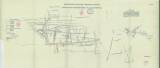
 Montangeologische Übersichtskarte des Staatlichen Bergrevieres St. Joachimsthal Montangeologische Übersichtskarte des Staatlichen Bergrevieres St. Joachimsthal(Synoptic mining-geological map of the Jáchymov state-owned mining district) Author: Kraus, Maximilian Author's comment: Year of origin 1913-1914 Country: Czech Republic; Czech Crownlands Document language: German Publisher: k.k. Ministerium für öfentliche Arbeiten, Wien, first edition Supplement (annex to Figure 4, printed on tracing paper) to a paper by M. Kraus: Das staatliche Uranpecherz-Bergbaurevier bei St. Joachimsthal in Böhmen, published in "Bergbau und Hütte", vol.1, Nos 1-2. Wien 1915 Year: 1915 Scale: 1 : 7 500 Theme of the map: geological map with Quaternary deposits, mining map Type: Map supplement Color: Coloured Form: Tracing paper Kind: Printed Original source for this digital copy : School of Mines – Technical University, Ostrava Original dimensions: 345 x 810 mm (height x width) |


