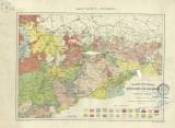
 Geologische Übersichtskarte des Königreichs Sachsen un angrenzender Landstriche (Nach Naumann und Cotta) Geologische Übersichtskarte des Königreichs Sachsen un angrenzender Landstriche (Nach Naumann und Cotta)Separaturausgabe aus Henry Lange's Atlas von Sachsen (General geological map the Kindom of Saxony and adjacent border areas (after Naumann and Cotta)) (Speciel issue from H.Lange’s Atlas of Saxomy) Author: Neuveden Author's comment: Revised 1881. Printed by F.A.Brockhaus, Leipzig Country: Czech Republic; Czech Crownlands; Saxony; Germany Document language: German Publisher: F. A. Brockhaus Geographische Anstalt, Leipzig, first edition Year: Scale: 1 : 590 000 Theme of the map: geological map without Quaternary deposits Type: Map Color: Coloured Form: Loose map Kind: Printed Original source for this digital copy : Map collection of the estate of Professor Kettner, Charles University, Prague |


