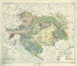
 Geologische Karte der Österreichisch-ungarischen Monarchie Geologische Karte der Österreichisch-ungarischen Monarchie(hauptsächlich nach Fr.R.v. Hauer) (Geological map of Austro-Hungarian Empire) ((mostly after Fr.r.v.Hauer)) Country: Czech Republic; Hungary; Italy; Poland; Slovenia; Slovakia; Czech Crownlands; Austria-Hungary; Croatia; Bosna a Hercegovina Document language: German Publisher: E. Hölzel, Wien, first edition Map sheet (No.11) from school atlas by V.v.Haardt Year: Scale: 1 : 4 000 000 Theme of the map: geological map without Quaternary deposits Type: Map Color: Coloured Form: Loose map Kind: Printed Original source for this digital copy : Map collection of Charles University, Prague Original dimensions: 300 x 371 mm (height x width) |


