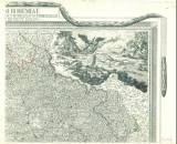
 Totius regni Bohemiae mappa chorographico-mineralogico-hydraulico-commercialis cum comitatu Glacensi et districtu Egrano Totius regni Bohemiae mappa chorographico-mineralogico-hydraulico-commercialis cum comitatu Glacensi et districtu Egrano[List 2] (Topographic mineralogical-industrial-trading map of the entire Kingdom of Bohemia with the Kladsko area and the Cheb region) (Map sheet 2 ) Author's comment: Drawn by J.F.de Bock and Polach Country: Czech Republic; Czech Crownlands Document language: French, latin, German Publisher: Artaria et socii, Wien, first edition A set of 4 map sheets with decorative frame for the whole map; in one color print with colored boundaries of Bohemia, 16 districts and large cities Year: 1808 Scale: 1 : 340 000 Theme of the map: map of mineral deposits, political map, topographical map Type: Map Color: Coloured Form: Set of sequential loose sheets Kind: Printed Original source for this digital copy : Map collection of Charles University, Prague Original dimensions: 416 x 527 mm (height x width) |


