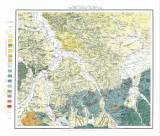
 Geognostische Karte von Ober-Schlesien Geognostische Karte von Ober-SchlesienSection Loslau (Blatt No.11) (Geological map of the Upper Silesia ) (Loslau section (map sheet No.11) ) Author's comment: Printed at Berliner lith.Institut Country: Czech Republic; Poland; Czech Crownlands; Germany Document language: German Publisher: J.H.Neumann, Berlin, first edition A map from the set of 12 map sheets (northern Moravia is covered by map sheets: 7-Loebschütz, 10-Troppau and 11-Loslau ; the set is likely to be connected with a publication by F.Roemer "Geologie von Ober-Schlesien", Breslau 1870 Year: Scale: 1 : 100 000 Theme of the map: geological map with Quaternary deposits Type: Map Color: Coloured Form: Loose map Kind: Printed Original source for this digital copy : Map collection of Charles University, Prague Original dimensions: 508 x 586 mm (height x width) |


