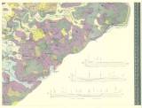
 Geologische und Gruben-Revier-Karte des Nordwestböhmischen Braunkohlenbeckens Geologische und Gruben-Revier-Karte des Nordwestböhmischen Braunkohlenbeckensherausgegeben vom vereinigten Brüx-Dux-Oberleutensdorfer Berg-Revier… [Bl.VI] (Geological and mine map of lignite basin in northwestern Bohemia) (Map sheet 6 ) Author: Fest, F. Author's comment: Lithography and typography by Th. Bannwarth, Wien Country: Czech Republic; Czech Crownlands Document language: German Publisher: Verlag des Bergrevieres Brüx-Dux-Oberleutensdorf, b.m., first edition Year: 1898 Scale: 1 : 25 000 Theme of the map: geological map with Quaternary deposits, map of mineral deposits Type: Map Color: Coloured Form: Set of sequential loose sheets Kind: Printed Original source for this digital copy : Czech Geological Survey, Prague Original dimensions: 561 x 714 mm (height x width) |


