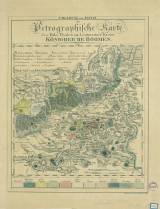
 Umgebung von Teplitz oder Petrographische Karte des Bila Thales im Leitmeritzer Kreise Königreiche Böhmen Umgebung von Teplitz oder Petrographische Karte des Bila Thales im Leitmeritzer Kreise Königreiche Böhmen(The environs of Teplice or a Petrographic map of the River Bílina valley in Litoměřice district of the Bohemian Kingdom ) Author: Reuss, Franz Ambrosius Author's comment: An information: "Teplitz bey J.Geržabek Spengler und Helm" is given under lower margin of the map Country: Czech Republic; Czech Crownlands Document language: German Publisher: publisher not specified, first edition A map entitled "Petrographische Karte des Biala-Thales im Leitmeritzer Kreise, Königreich Böhmen" together with the date -1829? is bound in Procházka's Repository Year: 1829? Theme of the map: geological map with Quaternary deposits Type: Map Color: Coloured Form: Loose map Kind: Printed Original source for this digital copy : State Technical Museum, Prague Original dimensions: 354 x 281 mm (height x width) |


