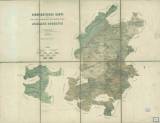
 Geognostische Karte der Fürstlich Colloredo Mannsfeld'schen Domaine Dobřisch Geognostische Karte der Fürstlich Colloredo Mannsfeld'schen Domaine Dobřisch(Geological map of the Colloredo-Mannsfeld estate Dobříš) Author: Baumann, Carl Author's comment: Based on geological observations by Ferdinant Fiscali, litogr.Mittag-Wildner, Praha Country: Czech Republic; Czech Crownlands Document language: German Publisher: Verlag des böhmischen Forstvereins, Prague, first edition The date of map compilation is given according to Roubík’s Soupis map (List of maps) Year: 1880? Scale: 1 : 70 000 Theme of the map: geological map with Quaternary deposits Type: Map Color: Coloured Form: Loose map Kind: Printed Original source for this digital copy : State Technical Museum, Prague Original dimensions: 455 x 500 mm (height x width) |


