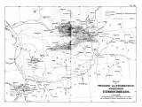
 Karte des preussisch- und oesterreichisch-schlesischen Steinkohlenbeckens Karte des preussisch- und oesterreichisch-schlesischen Steinkohlenbeckens(Map of Prussian- and Austrian-Silesian hard-coal basin) Author's comment: Compiled according to Carnall's map of Upper Silesia and Jahn’s mine map of the Ostrava hard-coal basin Country: Czech Republic; Czech Crownlands; Prussian Silesia Document language: German Publisher: R. Oldenbourg, München, first edition Published (Figure 21) in map collection by H.B.Geinitz: Atlas zur Geologie der Steinkohlen Deutschland's und anderer Länder Europa's; Year: 1865 Scale: 1 : 375 000 Theme of the map: map of mineral deposits Type: Map supplement Color: Black and white Form: Bound appendix Kind: Printed Original source for this digital copy : Library of the Faculty of Science, Charles University, Prague Original dimensions: 225 x 306 mm (height x width) |


