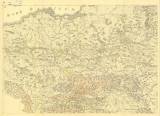
 Carta Geologica Totius Poloniae, Moldaviae, Transilvaniae, et Partis Hungariae, et Valachiae Carta Geologica Totius Poloniae, Moldaviae, Transilvaniae, et Partis Hungariae, et Valachiae[List] D (Geological map of entire Poland, Moldavia, Transylvania and parts of Hungary and Valachia ) Author: Staszic, Stanisław Author's comment: Drawn by Hoffman. Sc.Frey Country: Poland Document language: Polish Publisher: Wydawnictwa geologiczne, Warszawa, first edition Set of 4 map sheets, 11 loose graphic inserts. Supplement to the book by S. Staszic: O ziemiorodztwie Karpatow, i inych gori i rownin Polski, published in Warsaw 1815. Facsimile of the book and maps reduced by 1/20, published in 1955 Year: 1806 Scale: 1 : 1 400 000 Theme of the map: geological map with Quaternary deposits Type: Map Color: Coloured Form: Atlas of loose folded sheets Kind: Printed Original source for this digital copy : Czech Geological Survey, Prague Original dimensions: 636 x 454 mm (height x width) |


