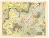
 [Geologische und Gruben-Revier-Karte des Kohlenbeckens von Teplitz-Dux-Brüx] Blatt 12 [Geologische und Gruben-Revier-Karte des Kohlenbeckens von Teplitz-Dux-Brüx] Blatt 12[nach den neuesten Aufnahmen entworfen und herausgegeben von Heinrich Wolf] ([Geological and mine map of the Teplice-Duchcov-Most] map sheet 12) (Supplement to the report of the Cheb Chamber of Commerce for 1863) Author: Wolf, Heinrich Author's comment: H.Wolf presumably published at his own expense Country: Czech Republic; Czech Crownlands Document language: German Publisher: b.v., Wien, first edition 16 map sheets are part of the set Year: 1880 Scale: 1 : 10 000 Theme of the map: geological map with Quaternary deposits, map of mineral deposits Type: Map Color: Coloured Form: Atlas of loose sheets Kind: Printed Original source for this digital copy : Czech Geological Survey, Prague Original dimensions: 551 x 711 mm (height x width) |


