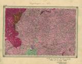
 Nr. XXVI. Umgebungen von Tabor Nr. XXVI. Umgebungen von Tabor[Special-Karte des Koenigreiches Boehmen] (Environs of Tábor) Author: Štúr, Dionýz Author's comment: Editor-in-chief: W.Haidinger (1863) Country: Czech Republic; Czech Crownlands Document language: German Publisher: K.k. Geologische Reichsanstalt, Wien, first edition Geological situation is delineated into the printed topographic groundwork of a special map derived from the II. military mapping (Francis´s) 1847-1860. Year: 1857 Scale: 1 : 144 000 Theme of the map: geological map with Quaternary deposits Type: Map Color: Coloured Form: Loose map Kind: manuscript Original source for this digital copy : Czech Geological Survey – Geofond, Prague Original dimensions: 269 x 392 mm (height x width) |


