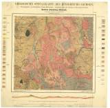
 Geologische Specialkarte des Königreichs Sachsen Geologische Specialkarte des Königreichs SachsenSection Annaberg-Jöhstadt No. 139 (Geological special map of the Kingdom of Saxony) (Section Annaberg-Jöhstadt, map sheet 139) Authors: Müller, Hermann; Schalch, F.; Gäbert, Carl Author's comment: 1st edition (1888) by F.Schalch, published in 1881, revised by C.Gäbert in 1902 Country: Czech Republic; Czech Crownlands; Saxony Document language: German Publisher: Königliche Finanz-Ministerium, Leipzig, second edition Year: 1904 Scale: 1 : 25 000 Theme of the map: geological map with Quaternary deposits Type: Map Color: Coloured Form: Loose map Kind: Printed Original source for this digital copy : Czech Geological Survey, Prague Original dimensions: 475 x 500 mm (height x width) |


