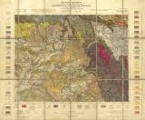
 [Geologische Spezialkarte der im Reichsrate vertretenen Königreiche und Länder der Österreichisch-Ungarischen Monarchie] [Geologische Spezialkarte der im Reichsrate vertretenen Königreiche und Länder der Österreichisch-Ungarischen Monarchie]Josefstadt und Nachod (der topographischen Spezialkarte Zone 4, Kol.XIV) (3858) (Geological special map of the Kingdom and countries constituting the Austro-Hungarian Empire) (Josefov and Náchod) Author: Petrascheck, W.J. Author's comment: With use of older materials of J. Jokély, H. Wolf, M.V. Lipold, K.M. Paul and E. Beyrich) Country: Czech Republic; Czech Crownlands Document language: German Publisher: K.k. Geologische Reichsanstalt, Wien, first edition editorial data and legend are glued overleaf of some map sheet copies Year: 1912 Scale: 1 : 75 000 Theme of the map: geological map with Quaternary deposits Type: Map Color: Coloured Form: Loose map Kind: Printed Original source for this digital copy : Czech Geological Survey, Prague Original dimensions: 383 x 498 mm (height x width) |


