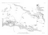
 Untergrund der Kreide und Präcretacische Schichtenverschiebungen in Böhmen Untergrund der Kreide und Präcretacische Schichtenverschiebungen in Böhmen(Basement of the Cretaceous and shifts of pre-Cretaceous strata in Bohemia) Author: Petrascheck, W.J. Author's comment: Typography by M. Jaffé, Wien Country: Czech Republic; Czech Crownlands Document language: German Publisher: Kaiserlich-königliche Geologische Reichsanstalt, Wien, first edition Supplement (Table 9) to a paper by W. Petrascheck: Über den Untergrund der Kreide und über präcretacische Schichtenverschiebungen in Nordböhmen, published in "Jahrbuch der k.k. geologischen Reichsanstalt", vol. 60. Wien 1910 Year: 1910 Scale: 1 : 450 000 Theme of the map: geological map without Quaternary deposits, documentation map of drilling and technical works Type: Map supplement Color: Black and white Form: Bound appendix Kind: Printed Original source for this digital copy : Czech Geological Survey, Prague Original dimensions: 311 x 460 mm (height x width) |


