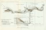
 Grundriss der I. Tiefbausohle, Kreuzriss durch den Neumaschinenschacht Grundriss der I. Tiefbausohle, Kreuzriss durch den Neumaschinenschacht[Geologická mapka okolí Mohelnice a Zábřehu] (Basic features of fotwall drift of the 1st level of underground mine,lateral section of the Neumaschinenschacht Mine) ([Geological sketch map of the surrounding of Mohelnice and Zábřeh]) Author: Kretschmer, Franz Country: Czech Republic; Czech Crownlands Document language: German Publisher: Kaiserlich-königliche Geologische Reichsanstalt, Wien, first edition Supplement (Table 17) to a paper by F.Kretchmer: : Die nutzbaren Minerallagerstätten der archäischen und devonischen Inseln Westmährens, published in "Jahrbuch der k.k. geologischen Reichsanstalt", vol.52/1902. Wien 1903 Year: 1903 Scale: 1 : 75 000 Theme of the map: geological map with Quaternary deposits Type: Graphic insert Color: Coloured Form: Bound appendix Kind: Printed Original source for this digital copy : Czech Geological Survey, Prague |


