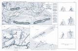
 Geognostische Karte des Rochlitzer Erz-Reviers Geognostische Karte des Rochlitzer Erz-Reviers(Geognostic map of the Rochlice ore district) Authors: Porth, Emil; Herter, Paul Author's comment: Typographer .k.k. Hof-und Staasdruckerei, Wien Country: Czech Republic; Czech Crownlands Document language: German Publisher: Kaiserlich-königliche Geologische Reichsanstalt, Wien, first edition Supplement (Table 1) to a paper by P. Hertera a E. Portha: Das Erzvorkommen zu Rochlitz am Südabhange des Reisengebirges, published in "Jahrbuch der k.k. geologischen Reichsanstalt", vol. 10 Wien 1859 Year: 1859 Scale: 1 : 120 Theme of the map: petrographical map Type: Map supplement Color: Black and white Form: Bound appendix Kind: Printed Original source for this digital copy : Czech Geological Survey, Prague Original dimensions: 96 x 235 mm (height x width) |


