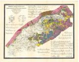
 Geologische und Gruben-Revier-Karte des Nordwestböhmischen Braunkohlenbeckens Geologische und Gruben-Revier-Karte des Nordwestböhmischen Braunkohlenbeckensherausgegeben vom vereinigten Brüx-Dux-Oberleutensdorfer Berg-Revier (Geological map and a map of mining district of the North Bohemian lignite basin ) (Published by united mining district of Most, Duchcov and Horní Litvínov) Author's comment: Karthogr. Anstalt v. Th.Bannwarth, Wien Country: Czech Republic Document language: German Publisher: Verlag des Bergrevieres Brüx-Dux-Oberleutensdorf, b.m., first edition A map published separately in 1898, and later also attached to a book: „Die Mineralkohlen Österreichs, Wien 1903 (independent insert/attachment - Tafel IX.) Year: 1903 Scale: 1 : 75 000 Theme of the map: map of mineral deposits, geological map with Quaternary deposits Type: Map Color: Coloured Form: Loose map Kind: Printed Original source for this digital copy : Czech Geological Survey, Prague Original dimensions: 576 x 723 mm (height x width) |


