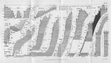
 Tab. IV. [Průřez morfologií krajiny, obr. 77-87] Tab. IV. [Průřez morfologií krajiny, obr. 77-87][Písčité mořské delta Jizery a Mohelky za doby pásma X.] (Table IV.[Cross-section of landscape morphology, Figs 77-87] ) ([Sandy deltas of the rivers Jizera and Mohelka at the times of Zone X] ) Author: Zahálka, Čeněk Author's comment: Lithography by Farský, Praha Country: Czech Republic; Czech Crownlands Document language: Czech Publisher: Česká společnost zeměvědná, Prague, first edition Appendix (Table 1) to a paper by Č.Zahálka: Zone X of Cretaceous System in the Jizera region, published in „Věstník Královské České společnosti náuk, Třída matematicko-přírodovědecká“, vol.1905, No.17. Praha 1906 Year: 1906 Scale: 1 : 216 000 Theme of the map: petrographical map Type: Graphic insert Color: Shades of gray Form: Bound supplement Kind: Printed Original source for this digital copy : Czech Geological Survey, Prague |


