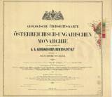
 Geologische Übersichts-Karte der Österreichisch-Ungarischen Monarchie nach den Aufnahmen der k.k. Geologischen Reichsanstalt Geologische Übersichts-Karte der Österreichisch-Ungarischen Monarchie nach den Aufnahmen der k.k. Geologischen ReichsanstaltBlatt I. (Synoptic geological map of the Austro-Hungarian monarchy) (Map sheet I. ) Author: Hauer, Franz Ritter von Author's comment: mapping campaign 1850, edition 1867-1871 Country: Czech Republic; Czech Crownlands Document language: German Publisher: Verlag der Böck'schen Universitäts - Buchhandlung, Wien, first edition Year: Scale: 1 : 576 000 Theme of the map: geological map with Quaternary deposits Type: Map Color: Coloured Form: Atlas of loose sheets Kind: Printed Original source for this digital copy : Czech Geological Survey, Prague Original dimensions: 591 x 617 mm (height x width) |