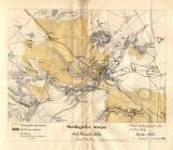
 Geologická mapa okolí Kutnohorského Geologická mapa okolí Kutnohorského(Geological map of the environs of Kutná Hora) Author: Kurz, Vilém Author's comment: Typography by A.F. Riedl, Německý (Havlíčkův) Brod Country: Czech Republic; Czech Crownlands Document language: German Publisher: C.k. učitelský ústav, Kutná Hora, first edition Supplement to a paper by V.Kurz: Geological scheme of the environs of Kutná Hora, published in "První veřejná zpráva c.k. učitelského ústavu v Kutné Hoře, 1877. Kutná Hora 1877 Year: 1877 Scale: 1 : 24 000 Theme of the map: geological map without Quaternary deposits, map of mineral deposits Type: Map supplement Color: Coloured Form: Bound appendix Kind: Printed Original source for this digital copy : Czech Geological Survey, Prague Original dimensions: 183 x 221 mm (height x width) |


