![[ENG]](img/vlajka-cr.gif) Česky
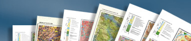
Česky The Digital Map Archive represents a unique collection of printed and manuscript geoscience maps from around the world. Here, you can find maps of various geological disciplines at various scales. The collection also includes maps dedicated to mining in the Czech Republic in 16th - 20th centuries.
In order to find a desired map, use the Quick Search or Detailed Search buttons in the top bar. The search result provides map information, a graphic preview, and any relevant map supplements (such as reports, explanatory notes, legends, geological sections). Map supplements may also be searched for separately via the Map Supplements button in the top bar.
The Map of the Czech Republic button allows you to work on an interactive search map of the Czech Republic (according to localities, administrative units or by drawing directly on the map). All relevant archive maps are linked to the territory of the Czech Republic and provided with a bibliographic description and preview.
Digital Map Archive Collections
Manuscript maps
These maps relate mainly to the territory of the Czech Republic and are usually supplemented with accompanying material (such as separate geological sections, legends, stratigraphic columns).
Printed maps
These maps include all countries of Europe, America, Asia, Africa and Australia. Various thematic maps (such as geological, economic geology, geophysical, tectonic) and scales are available. They are largely accompanied by printed explanatory notes.
Mining-related maps
These are original and copies of manuscript and printed maps, plans and sketch-maps, all of which are related to mining in the Czech Republic during the 16th?20th centuries. The collection also includes previews of mining maps belonging to the collections of cooperating institutions and archives of the Czech Republic. The maps of the Regional Museum in Jílové u Prahy, the Moravian Provincial Archives in Brno, and the State Regional Archives in Zámrsk are currently accessible to the public.
Map supplements
These are materials that accompany maps and facilitate their interpretation, such as explanatory notes, separate geological sections, map legends or stratigraphic columns.
Contact:
Ing. Katarína Černá, katarina.cerna at geology.cz
Česká geologická služba
Kostelní 364/26
170 06 Praha 7
tel.: +420234742204
Mgr. Jolana Šanderová, jolana.sanderova at geology.cz
Archiv báňských map Kutná Hora
Dačického nám.11,
284 01 Kutná Hora
tel.: +420327313248
See also information on CGS archives in Czech : Archivy (https://cgs.gov.cz/knihovna-archivy-sbirky/archivy) .